Florida Braces for Days of Heavy Rain, Gusty Winds and Flooding Concerns

A prolonged stretch of wet and windy weather is taking aim at Florida, raising concerns about flash flooding, dangerous surf and coastal erosion as a storm system impacts the Sunshine State.
A persistent flow of moisture from the Atlantic Ocean is expected to fuel repeated rounds of showers and thunderstorms across Florida throughout the week. With the potential for rain to fall over the same locations for several days, flooding could become a growing concern, especially in low-lying and poorly drained communities. However, this might seem like Deja Vu, with this upper-level low sinking through the Sunshine State, it is the same setup that brought us the catastrophic flooding across Melbourne.
WHAT TO EXPECT
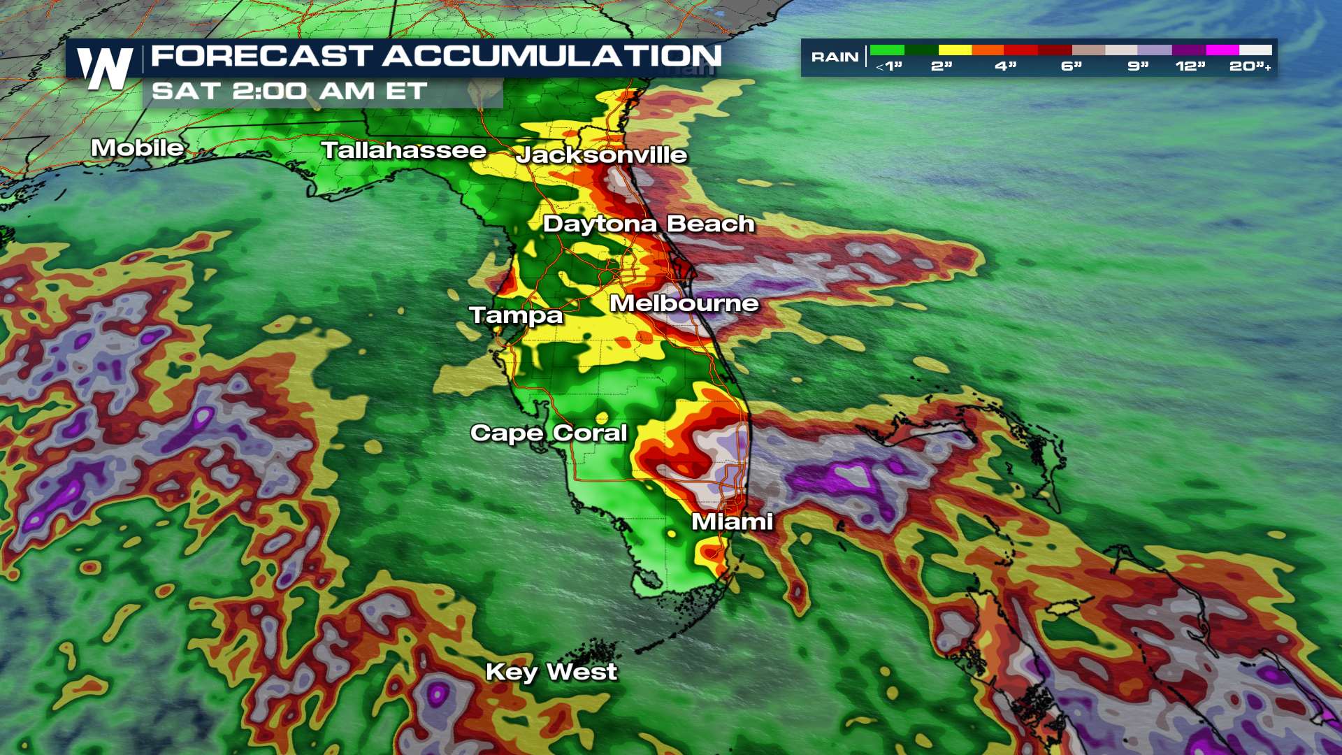
Florida’s Atlantic Coast is expected to experience some of the most significant impacts. Several inches of rain could accumulate in portions of the state, with locally higher totals possible where heavier showers repeatedly develop. Saturated ground and overwhelmed drainage systems could increase the risk of street flooding and hazardous driving conditions. The Weather Prediction Center has upgraded those odds to a MODERATE (level 3 out of 4) risk for that flash flooding in spots like Melbourne for the next three days.
TIMING
Rain chances will remain high through the weekend. The highest probability for precipitation will be on the east coast of Florida. Communities along the Space Coast, Treasure Coast, and portions of northeastern Florida could face an extended period of unsettled weather. Residents in areas vulnerable to flooding should remain alert as additional rainfall could quickly worsen conditions.
TOTALS
Along the I-95 corridor, 6 to 7 inches of rain will be possible; some isolated totals could go even higher.
The wet weather will also be accompanied by gusty onshore winds, creating another set of challenges for coastal communities. Strong winds pushing water toward the shoreline could lead to minor coastal flooding, while rough surf and dangerous rip currents make conditions hazardous for beachgoers.
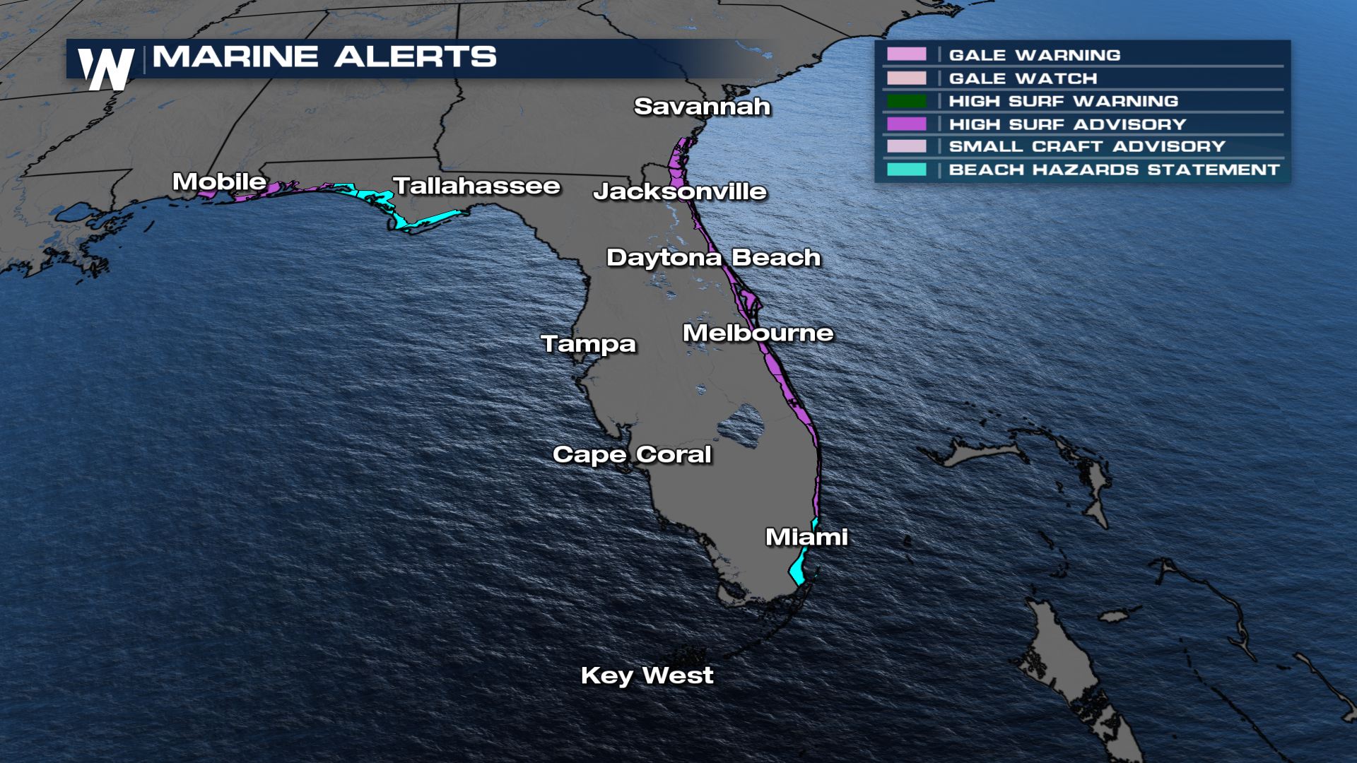
The stormy pattern is being driven by a combination of atmospheric disturbances and persistent easterly winds, which will continue transporting Atlantic moisture across the peninsula. This setup could allow showers to develop repeatedly, limiting opportunities for already wet areas to dry out.
Conditions may gradually improve as the weather system shifts away from Florida.
Join us on WeatherNation at:10 past the hour for your full eastern U.S. breakdown.


